- World Political Map : Map For Students (30 Inches X 20 Inches)
Buy anything from 5,000+ international stores. One checkout price. No surprise fees. Join 2M+ shoppers on Desertcart.
Desertcart purchases this item on your behalf and handles shipping, customs, and support to Vietnam.
Description
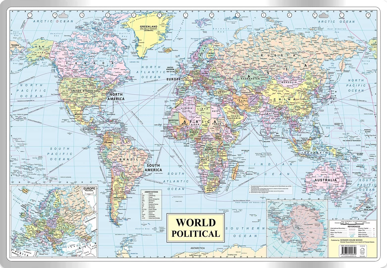
This is a syllabus friendly political map of the world meant for students. The student can study about the geographical locations of countries, their capitals and other important cities. It also depicts major shipping routes, sea ports, air ports and National highways. The map depicts the accurate flow of Rivers and lakes. These additional valuable information will help the student learn more about the world's Geography. The map is sturdy and can withstand lot of wear and tear without getting crumpled. The map is easy to hang on a wall with a nail. The dimensions of the map are 30 inches X 20 inches and have been approved by survey of India. This map is also useful for UPSC, SSC, Banking, Railways and other competitive exam preparations.


Specifications
| Best Sellers Rank | #10,404 in Books ( See Top 100 in Books ) #4 in Travel Tips #18 in Maps & Atlases #219 in UPSC Civil Services |
| Customer Reviews | 4.0 out of 5 stars 400 Reviews |
Reviews
A**R
T**F
S**P
I**A
J**U
S**U
L**A
D**P
C**M
A**E
Common Questions
Trustpilot