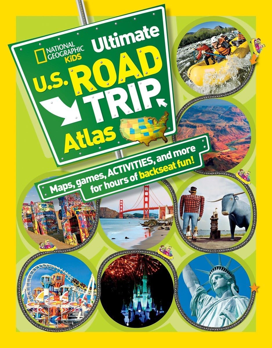
National Geographic Kids Ultimate U.S. Road Trip Atlas: Maps, Games, Activities, and More for Hours of Backseat Fun
Product ID: 316476644
Buy anything from 5,000+ international stores. One checkout price. No surprise fees. Join 2M+ shoppers on Desertcart.
Desertcart purchases this item on your behalf and handles shipping, customs, and support to Vietnam.
Buy National Geographic Kids Ultimate U.S. Road Trip Atlas: Maps, Games, Activities, and More for Hours of Backseat Fun by Boyer, Crispin, National Geographic Kids online on desertcart.ae at best prices. ✓ Fast and free shipping ✓ free returns ✓ cash on delivery available on eligible purchase. Review: good book Review: Brill - we used this as a guide to seeing key places/points of interest on our roadtrip
| Customer reviews | 4.7 4.7 out of 5 stars (1,254) |
| Dimensions | 21.59 x 0.71 x 27.46 cm |
| Edition | 3/21/12 |
| Grade level | 3 - 7 |
| ISBN-10 | 1426309333 |
| ISBN-13 | 978-1426309335 |
| Item weight | 340 g |
| Language | English |
| Print length | 128 pages |
| Publication date | 3 April 2012 |
| Publisher | National Geographic Kids |
| Reading age | 8 - 12 years |
A**R
good book
U**A
Brill - we used this as a guide to seeing key places/points of interest on our roadtrip
A**A
子供向けのロードマップ。 フルカラーで内容も面白い。 旅行にもお勧めです
M**E
Lots of activities for the read trip. Interesting facts for kids. Great book. Would definitely recommend it for the road trip
C**K
One reviewer made it sound like there's not much to this atlas. I'm a high school teacher, and I notice that many items generically labeled 'for kids' don't have a specific audience or age range in mind. This book is recommended for kids 8 and up. We have a 5 year old and an 11 year old. The 11 year old thinks it's a great trivia book with tons of maps. Our 5 year old thinks it's cool that he has his own maps, like the ones on our navigation system. The book is colorful, magazine-sized, and very appealing, visually. Most states get a 2-page spread, with a map of the state on one page, 5 Cool Things to do Here surround the map, with colored pointers to their locations, and off to the side a few smaller sections like popular roadside attractions (usually 3), and either a Fantastic State Facts or Traffic Laws You Won't Believe section. There is a brief description of the geography of each state, and images of the state bird, flower, and animal are near the state's name. Each state also has its own Boredom Buster that will occupy kids for quite a while, though they can be technology-focused. Examples include taking pictures of Clinton references as you travel through Arkansas, searching for famous people from Iowa and see who can find the most, taking pictures of tornado shelters in Kansas and see who can find the most, etc. It also includes 10 pages of games at the back which are colorful, but probably won't last more than a half hour. Some critics have made it sound like there's not much to the book. I can see that argument in one sense. There's not enough information to occupy bored kids for several hours, as you drive through a state. I do agree with the comment that the US map is too small. With the format of the book, the map could have been nearly 11 x 17, yet it's shrunk down to about 2/3 of the available space with a large, wasted green border around it. It's a good map, showing the Interstate highways with approximate drive times between each major city. It's a great way for kids to practice their time and math skills. It's just disappointing that it could have been substantially larger without changing its focus or function in any way. As a kid's atlas with lots of added trivia, it's WAY more interesting for my two boys than a regular atlas. Could they have included more information? Yes, but they could have made the pages too overwhelming for younger readers, too. I think the colorful design and layout make the atlas accessible for a wide range of ages. Though most suited for 8-12 year olds, I know many of my high school students would prefer this to a standard atlas for the trivia and layout, alone.
Trustpilot
2 months ago
1 month ago